Key Features
Everything you need to understand and interpret IOF control descriptions and map symbols.
Browse, search, and filter through all the official IOF control description and map symbols organized by category.
Challenge yourself with quizzes on both control descriptions and map symbols, ranging from beginner to advanced levels. Get immediate feedback.
What are Control Descriptions and Map Symbols?
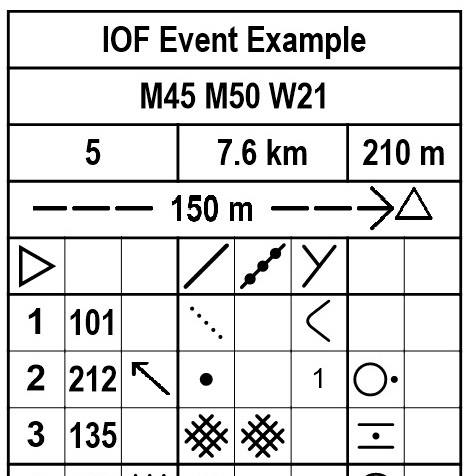
Control descriptions are a standardized set of symbols used in orienteering to describe the control points that competitors must visit. They provide precise information about the location and nature of each control.
Map symbols are the standardized graphical elements used on orienteering maps to represent different terrain features, vegetation, and man-made objects.
The International Orienteering Federation (IOF) has established these universal symbol systems that transcend language barriers, making orienteering competitions accessible worldwide.
Why Learn These Symbols?
- Essential for participating in orienteering events
- Provides crucial information about control locations
- Universal system used in competitions worldwide
- Helps with route planning and decision making
- Increases confidence and performance in the field